CHC Navigation (CHCNAV) CoProcess 2026.1.0
CHCNAV CoProcess 2026.1.0 is an advanced LiDAR point cloud processing solution engineered to transform massive survey datasets into accurate 3D models, DEMs, DTMs, and CAD-ready deliverables with exceptional efficiency.
Featuring AI-powered classification, terrain modeling, feature extraction, and Scan-to-CAD workflows, it streamlines professional geospatial mapping, engineering, mining, and infrastructure projects while supporting large-scale datasets.
Designed for surveyors, GIS specialists, and geospatial professionals, CHCNAV CoProcess 2026.1.0 delivers high-performance visualization, precision analysis, and productivity-focused tools for faster and more reliable point cloud post-processing.
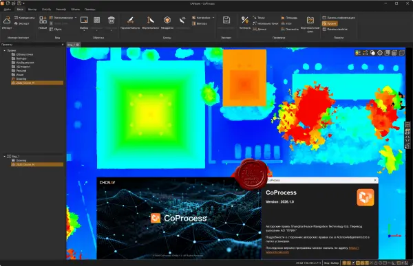
CoProcess is professional software from CHC Navigation (CHCNAV) for processing laser scanning data and point clouds.
CoProcess's key features include:
LiDAR point cloud processing;
automatic object classification (land, buildings, vegetation, etc.);
creation of digital elevation models (DEM/DSM);
creation of contour lines;
data conversion to CAD drawings (Scan-to-CAD);
calculation of embankment, quarry, and material storage volumes;
export of results to AutoCAD, ArcGIS, and other GIS/CAD systems.
2.06GB
Download
🔒 Upgrade
CHCNAV CoProcess 2026.1.0 is an advanced LiDAR point cloud processing solution engineered to transform massive survey datasets into accurate 3D models, DEMs, DTMs, and CAD-ready deliverables with exceptional efficiency.
Featuring AI-powered classification, terrain modeling, feature extraction, and Scan-to-CAD workflows, it streamlines professional geospatial mapping, engineering, mining, and infrastructure projects while supporting large-scale datasets.
Designed for surveyors, GIS specialists, and geospatial professionals, CHCNAV CoProcess 2026.1.0 delivers high-performance visualization, precision analysis, and productivity-focused tools for faster and more reliable point cloud post-processing.
CoProcess is professional software from CHC Navigation (CHCNAV) for processing laser scanning data and point clouds.
CoProcess's key features include:
LiDAR point cloud processing;
automatic object classification (land, buildings, vegetation, etc.);
creation of digital elevation models (DEM/DSM);
creation of contour lines;
data conversion to CAD drawings (Scan-to-CAD);
calculation of embankment, quarry, and material storage volumes;
export of results to AutoCAD, ArcGIS, and other GIS/CAD systems.
2.06GB
Download
🔒 Upgrade


