CHC Geomatics Office 2 v2.3.1
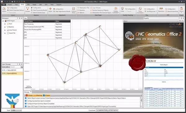
CHC Geomatics Office Software (CGO) 2.0 is a powerful office software, designed for engineers as an integrated platform to make a link between field and office workflow from multiple sensors and generating rich deliverables.
The second version of the popular software product CGO will please you with the following innovations:
- Updated interface for ease of use
- RTK module for working with LandStar7 software data
- Support Cloud.PrinCe - exchange between the office and the field without wires
- Public cadastral map of Rosreestr
- Joint and separate processing of GLONASS, NAVSTAR GPS, BeiDou, Galileo data
- Import formats from various manufacturers of satellite equipment, including RINEX
- Automatic quality control to ensure the reliability and validity of the resulting solution
- UAV module for processing PPK data from DJI drones and more
The new version of the CGO software retains the ease of use of the basic functions of the previous version, but at the same time has gained new features that allow you to make the best use of the functions of PinCe office and field software.
The CGO software allows you to process satellite data from all existing global navigation systems (GLONASS, NAVSTAR GPS, BeiDou and Galileo). The program is designed for post-processing of static measurements and measurements in kinematics mode (PPK), as well as work with RTK projects by synchronizing data directly with the controller or cloud service.
Viewing the results using an online map service, such as Google, OSM, Bing or Rosreestr's public cadastral map, provides a convenient way to control the measurements taken.
In addition to supporting the PrinCe raw measurement format, CGO supports proprietary formats from satellite surveying equipment manufacturers, allowing full integration with your existing equipment.
Due to the modular structure of the program, you can configure the software in accordance with the tasks to be solved.
Main features of CGO software:
- Post-processing of static and kinematic observations
- Support for GLONASS, NAVSTAR GPS, BeiDou and Galileo data
- Availability of many raw data import formats: RINEX v2.x, v 3.x, PrinCe HCN, HRC, Novatel NOV, Trimble OEM BD9, uBlox
- Import of airborne and high-precision ephemeris from the Internet
- Import LandStar 7 projects from the controller
- Import data from FTP
- Control of source information during import of raw GNSS data
- Various types of reports in HTML format: Baseline Processing, Network Adjustment, Polygon Closing
- Individual report settings to get all the necessary information
- Adjustment of the processed vectors in the geocentric rectangular coordinate system with the possibility of setting the starting points in plan and in height.
- Support for the default parameters of the main Russian coordinate systems according to GOST (SK42, SK95, MSK-XX)
- Create custom coordinate systems with the ability to apply geoid models
- Determination of communication parameters of an unknown system and WGS84 according to satellite geodetic measurements at GGS points with known coordinates (calibration)
- Download online maps as a background (Google, Bing, OSM, Rosreestr)
- Solving problems of coordinate geometry using points on the map
- Ability to process stand-alone static measurements using the PPP (Precise point positioning) method
- Export to various formats, incl. custom: txt, csv, dxf, shp, kml
- Data synchronization with controller and cloud service
Size: 1.28 GB
Download
http://s19.alxa.net/one/2023/08/CHC...e.2.v2.3.1.rar
