Site Suitability Analyse Using GIS (QGIS/ARCGIS)
Spatial Analyses with QGIS/ Opensource and free software
What you'll learn
AHP Analysis
QGIS Spatial Analyses
Geoproccessing
Conversion from vector-raster/raster-vector
How to calculate suitability areas
How to make raster analysis
How to manage rasters for analysis
How to take print
How to create thematic layers in QGIS
Weighted Overlay Analysis and more ....
Description
I will show you how to find Site Suitability for ANY STUDY AREA in the world by using QGIS and ArcGIS.
QGIS is free as you know!No need to pay licence cost!Learn the method and use it for other analyses.
No need to know ArcGIS much, i will show you easy and basic steps.Basic QGIS Usage is also enough.
Im sharing AHP Excel Sheet with you! By the way , you can also be able to do different analysis for ANY of Study Area.
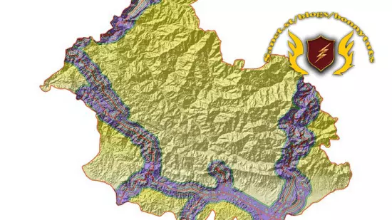
The weights and effects of 7 different layers were calculated for the Site Suitability analysis with the AHP multiple decision making method. The use of Geographic Information Systems (GIS) in analysis studies is increasing day by day.
In the course I prepared for Landslide Risk Analysis with QGIS/ARCGIS I will show you how to determine from scratch in detail the Site Suitability Analysis with AHP in a place of India, with a high probability of urban development using the "Multiple Decision Criteria" method.
Throughout the course, you will be actively introduced to QGIS Basic commands and how to use complex spatial analysis techniques in the following sections.
* Thematic Map layer creation,
*Raster operations (cutting, merging, SRTM data according to the border),
*Classification of raster data (Reclassify)
*Defining a common projection system for Map Layers,
*Dissolve process (Integration by Grid Code)
*Conversion from raster to vector/vector to raster (Conversion automaticly/not MANUALY)
*Using Batch command for dissolve/conversion proccess
* Geoprocessing operations, raster analysis,
* Exporting vector and raster data in the desired coordinate system,,
*AHP method
*Weighted Overlay Analyze
*Area calculation of criteria *
*More processes such as Cartographic Design and printing will be explained to you in detail.
Unlike other courses, you will learn to prepare using the AHP by using AHP excel sheet in order to calculate the weights of the basic criteria we will use for the analysis (finding the effect of the criteria on the analysis), and you will be able to print your standard maps with quality cartographic designs.
Who this course is for
Planners
Surveying Engineers
GIS Specialist
Geographers
GIS Users
Othher Engineer Departments
Requirements
QGIS (Any version)
ArcGIS
Basic QGIS Usage
Published 10/2022
MP4 | Video: h264, 1280x720 | Audio: AAC, 44.1 KHz, 2 Ch
Genre: eLearning | Language: English | Duration: 17 lectures (3h 35m) | Size: 1.59 GB
Download
http://s6.alxa.net/one/2022/10/Site...QGISARCGIS.rar
Spatial Analyses with QGIS/ Opensource and free software
What you'll learn
AHP Analysis
QGIS Spatial Analyses
Geoproccessing
Conversion from vector-raster/raster-vector
How to calculate suitability areas
How to make raster analysis
How to manage rasters for analysis
How to take print
How to create thematic layers in QGIS
Weighted Overlay Analysis and more ....
Description
I will show you how to find Site Suitability for ANY STUDY AREA in the world by using QGIS and ArcGIS.
QGIS is free as you know!No need to pay licence cost!Learn the method and use it for other analyses.
No need to know ArcGIS much, i will show you easy and basic steps.Basic QGIS Usage is also enough.
Im sharing AHP Excel Sheet with you! By the way , you can also be able to do different analysis for ANY of Study Area.
The weights and effects of 7 different layers were calculated for the Site Suitability analysis with the AHP multiple decision making method. The use of Geographic Information Systems (GIS) in analysis studies is increasing day by day.
In the course I prepared for Landslide Risk Analysis with QGIS/ARCGIS I will show you how to determine from scratch in detail the Site Suitability Analysis with AHP in a place of India, with a high probability of urban development using the "Multiple Decision Criteria" method.
Throughout the course, you will be actively introduced to QGIS Basic commands and how to use complex spatial analysis techniques in the following sections.
* Thematic Map layer creation,
*Raster operations (cutting, merging, SRTM data according to the border),
*Classification of raster data (Reclassify)
*Defining a common projection system for Map Layers,
*Dissolve process (Integration by Grid Code)
*Conversion from raster to vector/vector to raster (Conversion automaticly/not MANUALY)
*Using Batch command for dissolve/conversion proccess
* Geoprocessing operations, raster analysis,
* Exporting vector and raster data in the desired coordinate system,,
*AHP method
*Weighted Overlay Analyze
*Area calculation of criteria *
*More processes such as Cartographic Design and printing will be explained to you in detail.
Unlike other courses, you will learn to prepare using the AHP by using AHP excel sheet in order to calculate the weights of the basic criteria we will use for the analysis (finding the effect of the criteria on the analysis), and you will be able to print your standard maps with quality cartographic designs.
Who this course is for
Planners
Surveying Engineers
GIS Specialist
Geographers
GIS Users
Othher Engineer Departments
Requirements
QGIS (Any version)
ArcGIS
Basic QGIS Usage
Published 10/2022
MP4 | Video: h264, 1280x720 | Audio: AAC, 44.1 KHz, 2 Ch
Genre: eLearning | Language: English | Duration: 17 lectures (3h 35m) | Size: 1.59 GB
Download
http://s6.alxa.net/one/2022/10/Site...QGISARCGIS.rar