MicroSurvey CAD 2027 v27.0.3.9964
MicroSurvey CAD – Professional Surveying and Civil Engineering CAD Software
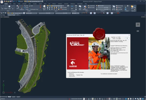
MicroSurvey CAD is a specialized CAD software solution for land surveyors, geomatics professionals, civil engineers, and engineering survey specialists. It is designed for processing survey measurements, creating topographic plans, working with coordinate data, and producing accurate CAD drawings based on field survey information.
MicroSurvey CAD combines professional computer-aided design (CAD) tools with specialized features for land surveying, geodetic calculations, topographic mapping, and engineering workflows. It is part of the MicroSurvey family of CAD software products, which focuses on surveying, mapping, civil engineering, and related technical applications.
The software is designed to help surveyors and engineering professionals move efficiently from field measurements and coordinate data to detailed survey drawings, topographic plans, terrain models, and land development documentation.
Key Features of MicroSurvey CAD
Surveying and Geodetic Calculations
MicroSurvey CAD provides tools for processing and analyzing survey data, including:
Coordinate calculations
Distance and angle calculations
Direction and bearing calculations
Survey point calculations
Processing of field survey measurements
These tools help surveyors accurately process field data and prepare it for further CAD and mapping work.
COGO – Coordinate Geometry
The software includes COGO (Coordinate Geometry) functionality for solving common surveying and coordinate geometry problems. Surveyors can calculate new points and coordinates based on measured distances, angles, directions, bearings, and other field observations.
COGO tools are useful for boundary surveys, construction layout, property surveys, and other land surveying applications.
Topographic Mapping and Survey Drafting
MicroSurvey CAD can be used to create detailed topographic maps and survey drawings from field data. Survey points can be imported, organized, labeled, and displayed within CAD drawings.
The software supports the preparation of:
Topographic plans
Survey drawings
Site plans
Survey point layouts
Field-to-finish drawings
Engineering survey documentation
Terrain Modeling and Contours
MicroSurvey CAD provides tools for working with terrain and elevation data, allowing users to create digital terrain models and generate contour lines.
These capabilities are useful for topographic surveying, site development, civil engineering, grading, and terrain analysis.
Land Surveying and Cadastral Drafting
The software can also be used for land surveying and cadastral drafting, including the preparation of property and land-related drawings.
Surveyors can use CAD tools to document property boundaries, parcels, measurements, coordinates, and other information required for land development and cadastral projects.
Professional CAD Drafting and Editing
MicroSurvey CAD provides standard CAD drafting and editing tools for creating and modifying technical drawings. Users can work with:
Layers
Blocks
Text and annotations
Dimensions
Polylines
Lines and arcs
Survey points and coordinate data
This allows survey professionals to combine specialized surveying calculations with a complete CAD drafting environment.
Survey and CAD Data Exchange
MicroSurvey CAD supports workflows that require the exchange of survey data, coordinate information, and CAD drawings. This makes it easier to move data between field surveying, CAD drafting, mapping, and engineering workflows.
MicroSurvey CAD for Surveyors and Engineering Professionals
With dedicated surveying, COGO, topographic mapping, terrain modeling, land surveying, and CAD drafting tools, MicroSurvey CAD provides a practical environment for professionals working with field survey data and engineering drawings.
It is particularly suited for land surveyors, surveying companies, civil engineers, geomatics professionals, land development specialists, and engineering survey teams who need to process survey measurements, manage coordinate data, create topographic plans, and produce accurate CAD documentation.
659MB
Download
🔒 Upgrade
MicroSurvey CAD – Professional Surveying and Civil Engineering CAD Software
MicroSurvey CAD is a specialized CAD software solution for land surveyors, geomatics professionals, civil engineers, and engineering survey specialists. It is designed for processing survey measurements, creating topographic plans, working with coordinate data, and producing accurate CAD drawings based on field survey information.
MicroSurvey CAD combines professional computer-aided design (CAD) tools with specialized features for land surveying, geodetic calculations, topographic mapping, and engineering workflows. It is part of the MicroSurvey family of CAD software products, which focuses on surveying, mapping, civil engineering, and related technical applications.
The software is designed to help surveyors and engineering professionals move efficiently from field measurements and coordinate data to detailed survey drawings, topographic plans, terrain models, and land development documentation.
Key Features of MicroSurvey CAD
Surveying and Geodetic Calculations
MicroSurvey CAD provides tools for processing and analyzing survey data, including:
Coordinate calculations
Distance and angle calculations
Direction and bearing calculations
Survey point calculations
Processing of field survey measurements
These tools help surveyors accurately process field data and prepare it for further CAD and mapping work.
COGO – Coordinate Geometry
The software includes COGO (Coordinate Geometry) functionality for solving common surveying and coordinate geometry problems. Surveyors can calculate new points and coordinates based on measured distances, angles, directions, bearings, and other field observations.
COGO tools are useful for boundary surveys, construction layout, property surveys, and other land surveying applications.
Topographic Mapping and Survey Drafting
MicroSurvey CAD can be used to create detailed topographic maps and survey drawings from field data. Survey points can be imported, organized, labeled, and displayed within CAD drawings.
The software supports the preparation of:
Topographic plans
Survey drawings
Site plans
Survey point layouts
Field-to-finish drawings
Engineering survey documentation
Terrain Modeling and Contours
MicroSurvey CAD provides tools for working with terrain and elevation data, allowing users to create digital terrain models and generate contour lines.
These capabilities are useful for topographic surveying, site development, civil engineering, grading, and terrain analysis.
Land Surveying and Cadastral Drafting
The software can also be used for land surveying and cadastral drafting, including the preparation of property and land-related drawings.
Surveyors can use CAD tools to document property boundaries, parcels, measurements, coordinates, and other information required for land development and cadastral projects.
Professional CAD Drafting and Editing
MicroSurvey CAD provides standard CAD drafting and editing tools for creating and modifying technical drawings. Users can work with:
Layers
Blocks
Text and annotations
Dimensions
Polylines
Lines and arcs
Survey points and coordinate data
This allows survey professionals to combine specialized surveying calculations with a complete CAD drafting environment.
Survey and CAD Data Exchange
MicroSurvey CAD supports workflows that require the exchange of survey data, coordinate information, and CAD drawings. This makes it easier to move data between field surveying, CAD drafting, mapping, and engineering workflows.
MicroSurvey CAD for Surveyors and Engineering Professionals
With dedicated surveying, COGO, topographic mapping, terrain modeling, land surveying, and CAD drafting tools, MicroSurvey CAD provides a practical environment for professionals working with field survey data and engineering drawings.
It is particularly suited for land surveyors, surveying companies, civil engineers, geomatics professionals, land development specialists, and engineering survey teams who need to process survey measurements, manage coordinate data, create topographic plans, and produce accurate CAD documentation.
659MB
Download
🔒 Upgrade