NV5 Geospatial Solutions (ex. Exelis, ex. ITT) ENVI, IDL, LiDAR, SARscape, Opticalcape v6.3
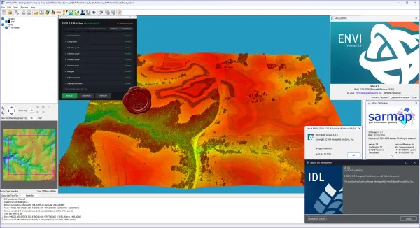
ENVI is a professional software product for the visualization and processing of Earth remote sensing data.
Purpose: Visualization and processing of remote sensing data; processing and analysis of multispectral and hyperspectral imagery; correction of geometric and radiometric distortions; interactive image enhancement; image georeferencing; orthorectification; creation of Digital Elevation Models (DEMs) from stereo imagery; 3D visualization; interactive image interpretation and classification; vegetation analysis using NDVI indices; analysis of radar imagery; raster data vectorization; support for a wide range of raster and vector formats; calibration and atmospheric correction.
System advantages: A wide range of input and output formats; no limitations on the size of images being processed; automatic and manual raster vectorization; dynamic access to GIS and database management systems; map creation and printing; hyperspectral image processing; tools for automating and simplifying comprehensive image processing and analysis, including spectral, topographic, and vegetation analysis; convenient online help with technical guidance and Internet-based resources; and the ability to use formulas and filters during image processing.
ENVI LiDAR is an interactive geospatial software environment that enables users to create realistic 3D visualizations and easily extract important features and products from raw LiDAR point cloud data. Elevation information from LiDAR can be used to create Digital Elevation Models (DEMs) or incorporated into geospatial products such as line-of-sight and right-of-way analyses. ENVI LiDAR can also be customized through its API to meet the specific requirements of different organizations.
SARscape provides advanced tools for processing Synthetic Aperture Radar (SAR) imagery and supports a wide range of existing SAR sensors, including RADARSAT-1/2, ENVISAT (ASAR), ALOS (PALSAR), TerraSAR-X, COSMO-SkyMed, ERS-1/2, JERS-1, and others. SARscape capabilities include radar interferometry for generating digital terrain models and detecting surface movements, polarimetry for creating composite polarimetric images and performing object classification, as well as various other advanced SAR processing techniques.
What’s New in ENVI 6.3
New supported data types, expanding compatibility with different raster data formats.
A significantly redesigned Data Manager with new capabilities.
ENVI Catalog now allows users to browse and open raster datasets directly from the catalog.
ENVI Server can be launched without GSF.
Task Scheduler enables ENVI tasks to be automated and executed according to a schedule.
Improved Viewshed Tool.
Enhanced Feature Counting functionality.
Location Pins can now be placed directly on the displayed scene.
Improved Grid Line Overlays.
PowerPoint templates can now be published to the ENVI Repository.
Vector data can now be saved in FileGDB format.
Added support for the Normalized Difference Red Index (NDRI).
Numerous tools in the ENVI Toolbox have been updated.
New and updated ENVI Tasks and Routines.
Updated ENVI Preferences settings.
What’s New in SARscape 6.3
SARscape 6.3.0 introduces support for PALSAR-3, NISAR, and BIOMASS, along with new SAR data formats and workflows for Amplitude Classifier, Coherence & Amplitude Classifier, Ship Detection / Oil Spill Classification, Inverse-SAR Detection and Refocusing, Radar Cross Section (RCS), and a range of new core SAR processing tools.
SARscape 6.3.1 introduces an even more notable feature: ENVI Agent integration, allowing users to define SAR processing operations using natural-language-style text commands.
7.85GB
Download
*
ENVI is a professional software product for the visualization and processing of Earth remote sensing data.
Purpose: Visualization and processing of remote sensing data; processing and analysis of multispectral and hyperspectral imagery; correction of geometric and radiometric distortions; interactive image enhancement; image georeferencing; orthorectification; creation of Digital Elevation Models (DEMs) from stereo imagery; 3D visualization; interactive image interpretation and classification; vegetation analysis using NDVI indices; analysis of radar imagery; raster data vectorization; support for a wide range of raster and vector formats; calibration and atmospheric correction.
System advantages: A wide range of input and output formats; no limitations on the size of images being processed; automatic and manual raster vectorization; dynamic access to GIS and database management systems; map creation and printing; hyperspectral image processing; tools for automating and simplifying comprehensive image processing and analysis, including spectral, topographic, and vegetation analysis; convenient online help with technical guidance and Internet-based resources; and the ability to use formulas and filters during image processing.
ENVI LiDAR is an interactive geospatial software environment that enables users to create realistic 3D visualizations and easily extract important features and products from raw LiDAR point cloud data. Elevation information from LiDAR can be used to create Digital Elevation Models (DEMs) or incorporated into geospatial products such as line-of-sight and right-of-way analyses. ENVI LiDAR can also be customized through its API to meet the specific requirements of different organizations.
SARscape provides advanced tools for processing Synthetic Aperture Radar (SAR) imagery and supports a wide range of existing SAR sensors, including RADARSAT-1/2, ENVISAT (ASAR), ALOS (PALSAR), TerraSAR-X, COSMO-SkyMed, ERS-1/2, JERS-1, and others. SARscape capabilities include radar interferometry for generating digital terrain models and detecting surface movements, polarimetry for creating composite polarimetric images and performing object classification, as well as various other advanced SAR processing techniques.
What’s New in ENVI 6.3
New supported data types, expanding compatibility with different raster data formats.
A significantly redesigned Data Manager with new capabilities.
ENVI Catalog now allows users to browse and open raster datasets directly from the catalog.
ENVI Server can be launched without GSF.
Task Scheduler enables ENVI tasks to be automated and executed according to a schedule.
Improved Viewshed Tool.
Enhanced Feature Counting functionality.
Location Pins can now be placed directly on the displayed scene.
Improved Grid Line Overlays.
PowerPoint templates can now be published to the ENVI Repository.
Vector data can now be saved in FileGDB format.
Added support for the Normalized Difference Red Index (NDRI).
Numerous tools in the ENVI Toolbox have been updated.
New and updated ENVI Tasks and Routines.
Updated ENVI Preferences settings.
What’s New in SARscape 6.3
SARscape 6.3.0 introduces support for PALSAR-3, NISAR, and BIOMASS, along with new SAR data formats and workflows for Amplitude Classifier, Coherence & Amplitude Classifier, Ship Detection / Oil Spill Classification, Inverse-SAR Detection and Refocusing, Radar Cross Section (RCS), and a range of new core SAR processing tools.
SARscape 6.3.1 introduces an even more notable feature: ENVI Agent integration, allowing users to define SAR processing operations using natural-language-style text commands.
7.85GB
Download
*