Autodesk Civil 3D Complete Course
Complete Roads & Highways Design with Autodesk Civil 3D
What you'll learn
⚡ Create and manage alignments, profiles, assemblies, corridors, surfaces, and sample lines for road design.
⚡ Develop detailed plan and profile drawings, cross-sections, quantities, and construction-ready design deliverables.
⚡ Apply practical Civil 3D techniques for grading, earthwork calculations, intersections, drainage, and highway design.
⚡ Prepare professional road design documentation and project outputs suitable for engineering and construction projects.
⚡ Build a complete road project from survey data through final design, analysis, documentation, and quantity calculations.
⚡ Design complete road and highway projects in Autodesk Civil 3D using professional industry workflows.
Requirements
❗ Basic knowledge of AutoCAD is recommended, but not mandatory.
❗ A computer capable of running Autodesk Civil 3D is required.
Description
Welcome toComplete Roads & Highways Design with Autodesk Civil 3D, a practical and project-focused course designed for civil engineers, surveyors, designers, students, and infrastructure professionals. This course provides a complete workflow for developing professional road and highway projects using Autodesk Civil 3D, from initial survey data through final design and documentation.
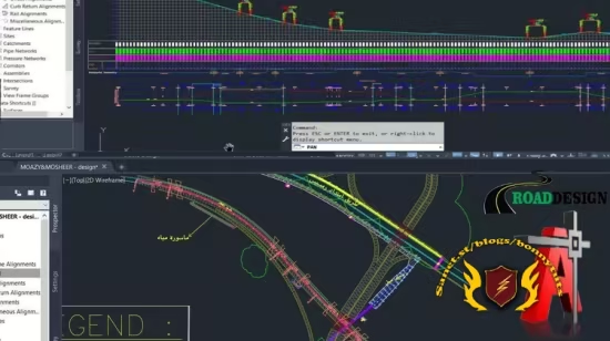
You will learn how to import and manage survey data, create COGO points, develop and analyze existing ground surfaces, and create professional horizontal alignments and vertical profiles. The course then progresses into roadway assemblies, typical sections, superelevation, corridor modeling, sample lines, cross sections, and earthwork quantity calculations. You will also explore feature lines, grading techniques, roundabout design, plan and profile production, engineering reports, and final project documentation.
The training focuses onreal-world engineering workflows, helping you understand not only how Civil 3D tools work, but also when and why they are used during a complete road design project. You will learn how different Civil 3D objects work together to create an accurate and coordinated roadway model.
This course is suitable forcivil engineering students, civil engineers, highway and transportation professionals, surveyors, CAD designers, site engineers, and construction professionals who want to improve their Civil 3D skills. Basic AutoCAD knowledge and fundamental civil engineering concepts are helpful, but advanced Civil 3D experience is not required.
By the end of the course, you will have a strong understanding of the completeSurvey → Surface → Alignment → Profile → Assembly → Corridor → Cross Section → Quantity → Plan Production workflow and be better prepared to apply Autodesk Civil 3D to professional roads, highways, and infrastructure projects.
Who this course is for
⭐ Civil engineering students and graduates who want practical road and highway design skills.
⭐ Civil engineers and site engineers who want to improve their Autodesk Civil 3D capabilities.
⭐ Anyone seeking practical, project-based training in Roads & Highways Design using Autodesk Civil 3D.
Published 8/2026
Created by Murad Farooq Jan
MP4 | Video: h264, 1920x1080 | Audio: AAC, 44.1 KHz, 2 Ch
Level: All Levels | Genre: eLearning | Language: English | Duration: 85 Lectures ( 10h 16m ) | Size: 7.92 GB
Download
🔒 Go Premium to Unlock
Complete Roads & Highways Design with Autodesk Civil 3D
What you'll learn
⚡ Create and manage alignments, profiles, assemblies, corridors, surfaces, and sample lines for road design.
⚡ Develop detailed plan and profile drawings, cross-sections, quantities, and construction-ready design deliverables.
⚡ Apply practical Civil 3D techniques for grading, earthwork calculations, intersections, drainage, and highway design.
⚡ Prepare professional road design documentation and project outputs suitable for engineering and construction projects.
⚡ Build a complete road project from survey data through final design, analysis, documentation, and quantity calculations.
⚡ Design complete road and highway projects in Autodesk Civil 3D using professional industry workflows.
Requirements
❗ Basic knowledge of AutoCAD is recommended, but not mandatory.
❗ A computer capable of running Autodesk Civil 3D is required.
Description
Welcome toComplete Roads & Highways Design with Autodesk Civil 3D, a practical and project-focused course designed for civil engineers, surveyors, designers, students, and infrastructure professionals. This course provides a complete workflow for developing professional road and highway projects using Autodesk Civil 3D, from initial survey data through final design and documentation.
You will learn how to import and manage survey data, create COGO points, develop and analyze existing ground surfaces, and create professional horizontal alignments and vertical profiles. The course then progresses into roadway assemblies, typical sections, superelevation, corridor modeling, sample lines, cross sections, and earthwork quantity calculations. You will also explore feature lines, grading techniques, roundabout design, plan and profile production, engineering reports, and final project documentation.
The training focuses onreal-world engineering workflows, helping you understand not only how Civil 3D tools work, but also when and why they are used during a complete road design project. You will learn how different Civil 3D objects work together to create an accurate and coordinated roadway model.
This course is suitable forcivil engineering students, civil engineers, highway and transportation professionals, surveyors, CAD designers, site engineers, and construction professionals who want to improve their Civil 3D skills. Basic AutoCAD knowledge and fundamental civil engineering concepts are helpful, but advanced Civil 3D experience is not required.
By the end of the course, you will have a strong understanding of the completeSurvey → Surface → Alignment → Profile → Assembly → Corridor → Cross Section → Quantity → Plan Production workflow and be better prepared to apply Autodesk Civil 3D to professional roads, highways, and infrastructure projects.
Who this course is for
⭐ Civil engineering students and graduates who want practical road and highway design skills.
⭐ Civil engineers and site engineers who want to improve their Autodesk Civil 3D capabilities.
⭐ Anyone seeking practical, project-based training in Roads & Highways Design using Autodesk Civil 3D.
Published 8/2026
Created by Murad Farooq Jan
MP4 | Video: h264, 1920x1080 | Audio: AAC, 44.1 KHz, 2 Ch
Level: All Levels | Genre: eLearning | Language: English | Duration: 85 Lectures ( 10h 16m ) | Size: 7.92 GB
Download
🔒 Go Premium to Unlock