HYPACK 2026.1
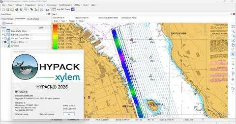
HYPACK 2026 is a world-leading hydrographic surveying and dredging software designed to deliver a complete, end-to-end solution for marine data acquisition, processing, and analysis. Widely used by professionals in hydrography, offshore engineering, and environmental surveying, this advanced platform enables users to efficiently manage every stage of a survey—from initial planning to final deliverables.
With HYPACK 2026, users can design survey lines, collect data from multiple sensors, apply real-time corrections, and generate high-precision outputs such as bathymetric maps, contours, and 3D models. The software supports a wide range of equipment including single beam and multibeam echosounders, side scan sonar, LiDAR, and magnetometers, making it a versatile solution for complex marine projects .
This latest version introduces significant enhancements, including improved Side Scan Survey tools (targeting and mosaicking), expanded magnetometer data processing, and new applications like Remora and Dredge Monitor, which enhance dredging operations and real-time monitoring capabilities. Additionally, support for GeoJSON background layers and improved visualization tools provide more flexibility in data integration and project analysis .
HYPACK 2026 also features advanced modules such as HYSWEEP® for multibeam data and DREDGEPACK® for dredging management, enabling professionals to handle everything from simple bathymetric surveys to complex offshore construction projects within a unified environment. Its powerful editing, filtering, and volume calculation tools ensure accurate results and high-quality deliverables.
Designed for surveyors, marine engineers, dredging contractors, and research institutions, HYPACK 2026 delivers unmatched reliability, flexibility, and performance. With its ability to integrate hundreds of sensors and streamline workflows, it remains one of the most trusted solutions for hydrographic survey software worldwide.
2.2GB
Download
🔒 Upgrade
HYPACK 2026 is a world-leading hydrographic surveying and dredging software designed to deliver a complete, end-to-end solution for marine data acquisition, processing, and analysis. Widely used by professionals in hydrography, offshore engineering, and environmental surveying, this advanced platform enables users to efficiently manage every stage of a survey—from initial planning to final deliverables.
With HYPACK 2026, users can design survey lines, collect data from multiple sensors, apply real-time corrections, and generate high-precision outputs such as bathymetric maps, contours, and 3D models. The software supports a wide range of equipment including single beam and multibeam echosounders, side scan sonar, LiDAR, and magnetometers, making it a versatile solution for complex marine projects .
This latest version introduces significant enhancements, including improved Side Scan Survey tools (targeting and mosaicking), expanded magnetometer data processing, and new applications like Remora and Dredge Monitor, which enhance dredging operations and real-time monitoring capabilities. Additionally, support for GeoJSON background layers and improved visualization tools provide more flexibility in data integration and project analysis .
HYPACK 2026 also features advanced modules such as HYSWEEP® for multibeam data and DREDGEPACK® for dredging management, enabling professionals to handle everything from simple bathymetric surveys to complex offshore construction projects within a unified environment. Its powerful editing, filtering, and volume calculation tools ensure accurate results and high-quality deliverables.
Designed for surveyors, marine engineers, dredging contractors, and research institutions, HYPACK 2026 delivers unmatched reliability, flexibility, and performance. With its ability to integrate hundreds of sensors and streamline workflows, it remains one of the most trusted solutions for hydrographic survey software worldwide.
2.2GB
Download
🔒 Upgrade