OpenSite Designer: AI Applied to Terrain Design - ...
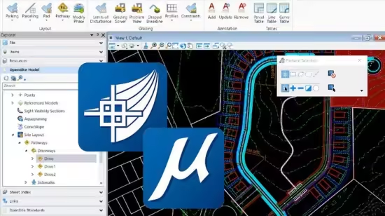
Master OpenSite Designer's AI tools for terrain and site layout design with practical, step-by-step exercises.
What you'll learn
How to get started with OpenSite Designer and set up your project files.
Navigation and manipulation of 2D and 3D views within the platform.
Define the Geographic Coordinate System (GCS) and work with terrain models.
Site layout design, including defining site boundaries, building footprints, and creating parking lots.
Reviewing and optimizing site designs using AI-powered features.
Requirements
Basic concepts of surveying
Description
Course Objective: This course provides hands-on training in OpenSite Designer, with a focus on applying artificial intelligence (AI) to streamline terrain and site layout design. Learners will engage in two structured exercises that cover core functionalities, from setup and project navigation to advanced grading and optimization using AI features. By the end of this course, students will have practical experience creating terrain models, defining site layouts, and using AI tools to optimize design processes efficiently.
What You Will Learn:Setting up OpenSite Designer and project files for efficient workflow Navigating and managing 2D and 3D views in the softwareWorking with the Geographic Coordinate System (GCS) for accurate terrain modeling Designing site layouts, including defining boundaries, building footprints, and parking areas Creating and optimizing connections, such as driveways and access points Applying advanced grading techniques to achieve precise terrain adjustments Using AI-driven tools to review and optimize site designs, enhancing productivity and accuracy Course Structure and Content:Part 1: Terrain Model and Site BasicsIn this exercise, students will learn how to set up the software environment, establish the project’s GCS, and navigate 2D and 3D views.
The focus is on creating and refining a terrain model, setting site boundaries, defining building footprints, and laying out primary site features. Key steps include:Getting Started and Navigation Geographic Coordinate System (GCS) Setup Terrain Model Creation and Editing Site Boundary Definition Building Footprint Layout Adding Main Driveways and Parking Lots Part 2: Enhancing and Finalizing Site Design with AI This advanced exercise introduces OpenSite Designer’s AI-powered tools for efficient site design adjustments and grading. Students will further develop their site by adding connections, such as driveways and sidewalks, creating parcels, and reviewing the design with AI to ensure accuracy and feasibility. Key steps include:Driveway and Access Connection Design Sidewalks and Pathways Integration Parcel Definition and Customization Project Grading with Advanced Techniques Site Review and Optimization with AI Tools By following these structured exercises, learners will gain comprehensive knowledge of OpenSite Designer, from initial setup to AI-driven design improvements, preparing them to apply their skills to real-world projects effectively.
Course Content: Exercise Overview Getting Started and Navigation Geographic Coordinate System (GCS) Setup Terrain Model Creation File Setup and Site Layout2D and 3D View Management Site Boundary and Building Footprint Definition Primary Driveways and Parking Layout Advanced Grading Techniques Driveway, Path, and Sidewalk Connections Parcel Creation and Customization AI-Powered Site Review and Optimization
Who This Course Is For:
Civil engineers, architects, and land developers looking to improve their terrain design skills.Professionals and students interested in AI applications in site design and layout.Anyone wanting to enhance their knowledge of OpenSite Designer for terrain modeling and site planning.
Who this course is for
Civil engineers, architects, and land developers looking to improve their terrain design skills.
Professionals and students interested in AI applications in site design and layout.
Anyone wanting to enhance their knowledge of OpenSite Designer for terrain modeling and site planning.
Last updated 7/2025
MP4 | Video: h264, 1920x1080 | Audio: AAC, 44.1 KHz, 2 Ch
Language: English | Duration: 1h 58m | Size: 1.72 GB
Download
🔒 Go Premium to Unlock
Master OpenSite Designer's AI tools for terrain and site layout design with practical, step-by-step exercises.
What you'll learn
How to get started with OpenSite Designer and set up your project files.
Navigation and manipulation of 2D and 3D views within the platform.
Define the Geographic Coordinate System (GCS) and work with terrain models.
Site layout design, including defining site boundaries, building footprints, and creating parking lots.
Reviewing and optimizing site designs using AI-powered features.
Requirements
Basic concepts of surveying
Description
Course Objective: This course provides hands-on training in OpenSite Designer, with a focus on applying artificial intelligence (AI) to streamline terrain and site layout design. Learners will engage in two structured exercises that cover core functionalities, from setup and project navigation to advanced grading and optimization using AI features. By the end of this course, students will have practical experience creating terrain models, defining site layouts, and using AI tools to optimize design processes efficiently.
What You Will Learn:Setting up OpenSite Designer and project files for efficient workflow Navigating and managing 2D and 3D views in the softwareWorking with the Geographic Coordinate System (GCS) for accurate terrain modeling Designing site layouts, including defining boundaries, building footprints, and parking areas Creating and optimizing connections, such as driveways and access points Applying advanced grading techniques to achieve precise terrain adjustments Using AI-driven tools to review and optimize site designs, enhancing productivity and accuracy Course Structure and Content:Part 1: Terrain Model and Site BasicsIn this exercise, students will learn how to set up the software environment, establish the project’s GCS, and navigate 2D and 3D views.
The focus is on creating and refining a terrain model, setting site boundaries, defining building footprints, and laying out primary site features. Key steps include:Getting Started and Navigation Geographic Coordinate System (GCS) Setup Terrain Model Creation and Editing Site Boundary Definition Building Footprint Layout Adding Main Driveways and Parking Lots Part 2: Enhancing and Finalizing Site Design with AI This advanced exercise introduces OpenSite Designer’s AI-powered tools for efficient site design adjustments and grading. Students will further develop their site by adding connections, such as driveways and sidewalks, creating parcels, and reviewing the design with AI to ensure accuracy and feasibility. Key steps include:Driveway and Access Connection Design Sidewalks and Pathways Integration Parcel Definition and Customization Project Grading with Advanced Techniques Site Review and Optimization with AI Tools By following these structured exercises, learners will gain comprehensive knowledge of OpenSite Designer, from initial setup to AI-driven design improvements, preparing them to apply their skills to real-world projects effectively.
Course Content: Exercise Overview Getting Started and Navigation Geographic Coordinate System (GCS) Setup Terrain Model Creation File Setup and Site Layout2D and 3D View Management Site Boundary and Building Footprint Definition Primary Driveways and Parking Layout Advanced Grading Techniques Driveway, Path, and Sidewalk Connections Parcel Creation and Customization AI-Powered Site Review and Optimization
Who This Course Is For:
Civil engineers, architects, and land developers looking to improve their terrain design skills.Professionals and students interested in AI applications in site design and layout.Anyone wanting to enhance their knowledge of OpenSite Designer for terrain modeling and site planning.
Who this course is for
Civil engineers, architects, and land developers looking to improve their terrain design skills.
Professionals and students interested in AI applications in site design and layout.
Anyone wanting to enhance their knowledge of OpenSite Designer for terrain modeling and site planning.
Last updated 7/2025
MP4 | Video: h264, 1920x1080 | Audio: AAC, 44.1 KHz, 2 Ch
Language: English | Duration: 1h 58m | Size: 1.72 GB
Download
🔒 Go Premium to Unlock