Fonix Geosciense LIME v3.3.1
LIME is specialized software for visualizing, interpreting, and presenting 3D geological and geospatial models. LIME is a 3D program designed to work with models obtained using photogrammetry, LiDAR (laser scanning), digital terrain processing, and other sources of 3D data. LIME is used in scientific, educational, and professional fields, especially in geology, geomorphology, geodesy, construction, mining, environmental research, and other areas where working with 3D geodata is required. LIME allows you to import, visualize, measure, annotate, and analyze these models, as well as combine them with GIS data, field observations, and interpretations. The program is widely used to create digital twins, virtual field trips, and project presentations – whether for research, education, or demonstrating results to clients.
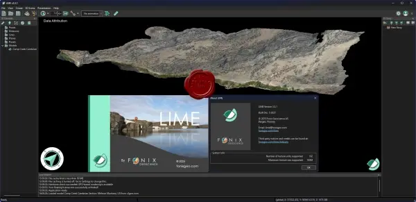
Key Features
Import and work with large 3D models (support for standard formats and cloud data)
Visualization and animation of scenes
Measurement and annotation tools
Integration with GIS and other data (e.g., subsurface panels or structural data)
Creation of 3D Stories – visual sequences for presentations and training
Support for virtual field tours and digital twins for project demonstrations
Includes a free Viewer mode for sharing projects without the full editor interface
31.5MB
Download
🔒 Go Premium to Unlock
LIME is specialized software for visualizing, interpreting, and presenting 3D geological and geospatial models. LIME is a 3D program designed to work with models obtained using photogrammetry, LiDAR (laser scanning), digital terrain processing, and other sources of 3D data. LIME is used in scientific, educational, and professional fields, especially in geology, geomorphology, geodesy, construction, mining, environmental research, and other areas where working with 3D geodata is required. LIME allows you to import, visualize, measure, annotate, and analyze these models, as well as combine them with GIS data, field observations, and interpretations. The program is widely used to create digital twins, virtual field trips, and project presentations – whether for research, education, or demonstrating results to clients.
Key Features
Import and work with large 3D models (support for standard formats and cloud data)
Visualization and animation of scenes
Measurement and annotation tools
Integration with GIS and other data (e.g., subsurface panels or structural data)
Creation of 3D Stories – visual sequences for presentations and training
Support for virtual field tours and digital twins for project demonstrations
Includes a free Viewer mode for sharing projects without the full editor interface
31.5MB
Download
🔒 Go Premium to Unlock