CGS Labs Civil Solution 2026.0.913 for AutoCAD/BricsCAD
CGS Labs is an established European developer in the field of transportation, infrastructure and AEC. Since 1990, CGS Labs has been developing and providing a family of professional high-end civil engineering applications for the design of roadways (Plateia), railways (Ferrovia) and river engineering works (Aquaterra) as well as Civil 3D and Revit software tools for civil engineers and architects. CGS Labs also develops customized CAD and BIM software solutions for different companies as well as software vendors such as Autodesk, CAD-Q, DHI.
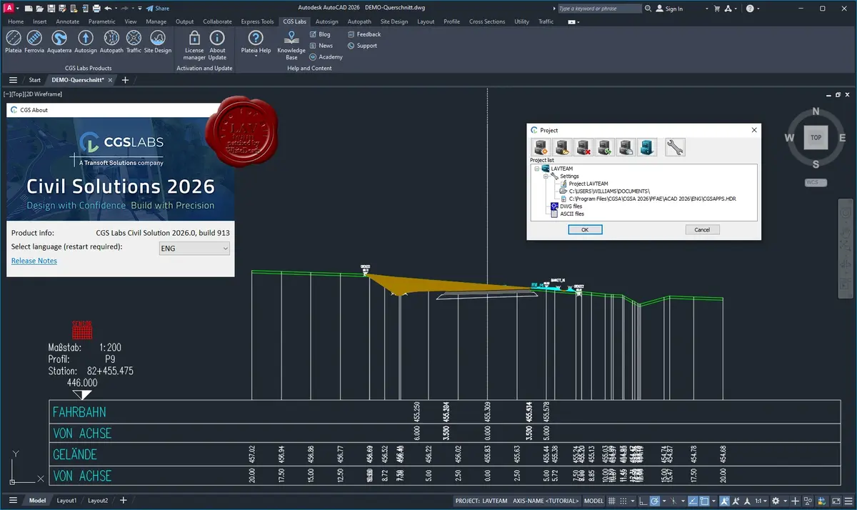
Components of the suite:
Plateia is a professional, BIM-ready, 3D road design and reconstruction software solution. Using its flexible, dynamic data model, it supports BIM workflows and processes, and IFC standardized data format.
Autopath is a professional software solution for vehicle swept path analysis used by civil engineers, transportation professionals, architects, and urban planners. Autopath enables the simulation and analysis of vehicle manoeuvres, 3D vehicle animation and more.
Autosign is a professional software solution for planning traffic signal design in Civil3D, AutoCAD, or BricsCAD. It generates detailed documentation, layouts, and reports. It generates detailed layouts, reports, 3D (BIM) objects, and realistic visualizations.
Ferrovia is a professional, BIM ready solution for railway design and rail track analysis compliant with country-specific guidelines. Using its flexible, dynamic data model, it supports BIM workflows and processes, and IFC standardized data format.
Aquaterra is a professional software for channel and river engineering design. It integrates MIKE FLOOD and HEC-RAS hydraulic calculations with flood protection design, torrent and landslide control, and irrigation systems design. Using its flexible, dynamic data model, it supports BIM workflows and processes, and IFC standardized data format.
File Size: 1.41 GB
Download
🔒 Go Premium to Unlock
CGS Labs is an established European developer in the field of transportation, infrastructure and AEC. Since 1990, CGS Labs has been developing and providing a family of professional high-end civil engineering applications for the design of roadways (Plateia), railways (Ferrovia) and river engineering works (Aquaterra) as well as Civil 3D and Revit software tools for civil engineers and architects. CGS Labs also develops customized CAD and BIM software solutions for different companies as well as software vendors such as Autodesk, CAD-Q, DHI.
Components of the suite:
Plateia is a professional, BIM-ready, 3D road design and reconstruction software solution. Using its flexible, dynamic data model, it supports BIM workflows and processes, and IFC standardized data format.
Autopath is a professional software solution for vehicle swept path analysis used by civil engineers, transportation professionals, architects, and urban planners. Autopath enables the simulation and analysis of vehicle manoeuvres, 3D vehicle animation and more.
Autosign is a professional software solution for planning traffic signal design in Civil3D, AutoCAD, or BricsCAD. It generates detailed documentation, layouts, and reports. It generates detailed layouts, reports, 3D (BIM) objects, and realistic visualizations.
Ferrovia is a professional, BIM ready solution for railway design and rail track analysis compliant with country-specific guidelines. Using its flexible, dynamic data model, it supports BIM workflows and processes, and IFC standardized data format.
Aquaterra is a professional software for channel and river engineering design. It integrates MIKE FLOOD and HEC-RAS hydraulic calculations with flood protection design, torrent and landslide control, and irrigation systems design. Using its flexible, dynamic data model, it supports BIM workflows and processes, and IFC standardized data format.
File Size: 1.41 GB
Download
🔒 Go Premium to Unlock


