nanoSoft GeoniCS 2022 v22.0.2
nanoCAD GeoniCS is a professional tool for automating design and survey work in the field of land management, surveys and general layout, design and modeling of engineering communications and linear-extended objects.
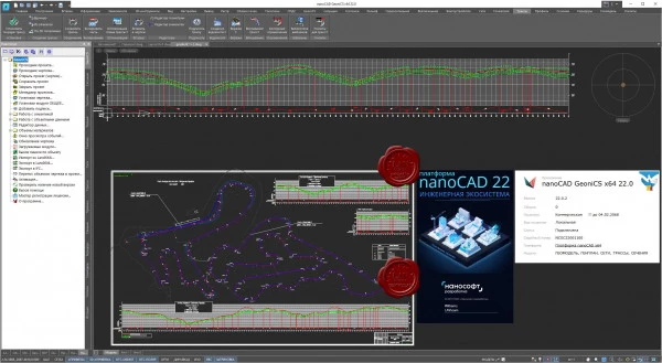
This is a completely domestic development with a convenient modular scheme of use, where each module is responsible for its own area of tasks. The core of the software package, the "Topoplan" module, solves the problems of creating, editing and analyzing digital elevation models and, thanks to the built-in library of conventional symbols, creates topographic plans.
The General Plan module is used in the design of industrial facilities for various purposes, as well as civil engineering facilities.
The module ensures full compliance with the requirements of GOST 21.508-93 “Rules for the implementation of working documentation for master plans for enterprises, structures and residential and civil facilities”, forms a set of documentation (layout drawing, relief organization plan, cartograms of earth masses, landscaping plan).
The "Networks" module allows you to design external on-site engineering communications, automatically receive the longitudinal profile of the network and draw up the necessary output documents. The "Routes" and "Sections" modules are equipped with functionality for designing linearly extended objects with the ability to work with a plan (route, horizontal axes), longitudinal profile and cross sections. The "Geomodel" module automates the process of preparation of graphic reporting documents of engineering-geological surveys (engineering-geological sections and columns).
The main tasks solved by the program:
creation of topographic plans;
preparation and creation of master plans for enterprises, structures and housing and civil facilities;
performing calculations related to the volume of earth masses;
design of external on-site engineering communications of underground and ground type;
design of linearly extended objects with the preparation of a plan, profile and cross sections;
formation of the output data of the information model of the surface and engineering communications (BIM);
formation of project documentation.
Size: 494 MB
Download
http://s19.alxa.net/one/2023/04/nanoS...22.v22.0.2.rar
nanoCAD GeoniCS is a professional tool for automating design and survey work in the field of land management, surveys and general layout, design and modeling of engineering communications and linear-extended objects.
This is a completely domestic development with a convenient modular scheme of use, where each module is responsible for its own area of tasks. The core of the software package, the "Topoplan" module, solves the problems of creating, editing and analyzing digital elevation models and, thanks to the built-in library of conventional symbols, creates topographic plans.
The General Plan module is used in the design of industrial facilities for various purposes, as well as civil engineering facilities.
The module ensures full compliance with the requirements of GOST 21.508-93 “Rules for the implementation of working documentation for master plans for enterprises, structures and residential and civil facilities”, forms a set of documentation (layout drawing, relief organization plan, cartograms of earth masses, landscaping plan).
The "Networks" module allows you to design external on-site engineering communications, automatically receive the longitudinal profile of the network and draw up the necessary output documents. The "Routes" and "Sections" modules are equipped with functionality for designing linearly extended objects with the ability to work with a plan (route, horizontal axes), longitudinal profile and cross sections. The "Geomodel" module automates the process of preparation of graphic reporting documents of engineering-geological surveys (engineering-geological sections and columns).
The main tasks solved by the program:
creation of topographic plans;
preparation and creation of master plans for enterprises, structures and housing and civil facilities;
performing calculations related to the volume of earth masses;
design of external on-site engineering communications of underground and ground type;
design of linearly extended objects with the preparation of a plan, profile and cross sections;
formation of the output data of the information model of the surface and engineering communications (BIM);
formation of project documentation.
Size: 494 MB
Download
http://s19.alxa.net/one/2023/04/nanoS...22.v22.0.2.rar