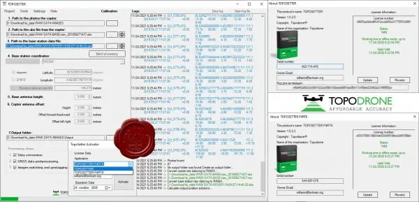
Topodrone TOPOSETTER v1.0.2.0 & TOPOSETTER P4RTK v1.0.2.2
TOPOSETTER is a simple but powerful tool for automatic post-processing of GNSS measurements in any coordinate systems and replacement of navigation coordinates in EXIF-tags of images with high-precision coordinates obtained after post-processing of GNSS data, provides a high level of accuracy of the output materials.
TOPOSETTER has additional automation capabilities that significantly reduce the amount of manual labor and save time spent on preparing data for further photogrammetric processing:
Processing of GNSS measurements in any coordinate systems
Loading coordinate systems from a PRJ file
GNSS data post-processing
Additional settings for GNSS measurements
Converting GNSS data from UBX format to RINEX
Antenna XYZ Offset Adjustment
Antenna tilt correction based on drone IMU data
Calibrated camera focal length calculation function
Adjusting the XY coordinates of photos depending on the shutter speed
Batch processing of multiple flights from one base station
Automatic mapping of images and coordinates
Automatic renaming of snapshots
Record high-precision XYZ coordinates of horizontal and vertical error in EXIF tags of photos
Ability to save a text file with coordinates in formats compatible with Pix4Dmapper and Agisoft Metashape
Calculation of coordinates of a base station using PPP technology
Supports JPG, TIFF, DNG formats for uploading aerial photos
TOPOSETTER for P4RTK is an enhanced version of TOPOSETTER with support for DJI Phantom 4 RTK.
A simple but powerful tool for automatic post-processing of GNSS measurements in any coordinate systems and replacement of navigation coordinates in EXIF-tags of images with high-precision coordinates obtained after post-processing of GNSS data, provides a high level of accuracy of the output materials. TOPOSETTER for P4RTK allows you to process GNSS data from DJI Phantom 4 RTK in PPK mode, so you don't need to connect to the Internet in the field and there is no need to connect a base station in RTK mode.
Size: 243 MB
Download
http://s6.alxa.net/one/2021/11/Topod...K.v1.0.2.2.rar