أداة لا غنى عنها لتصميم الكسارات والمقالب ، ولتحكم دوري في التحكم ، وصياغة خطط الزراعة ، لإدارة تقارير المحاسبة والتقارير المرحلية.
مدخلات من البيانات الطبوغرافية وحساب الأحجام حسب المقاطع ومن قبل prismides وفقا لطرق مختلفة
مثلث ، شبكة ، تمثيل كفاف ثنائي وثلاثي الأبعاد
إدارة الرسم المتقدمة وحساب القسم
إدارة النقاط المذكورة ونموذج التضاريس الرقمية في أرشيف واحد حيث يمكن إدراج المزيد من المسوحات الطبوغرافية
حساب ردم التربة من أجل التسطيح ، الأحواض الاصطناعية ، المحاجر ، الأحواض الأرضية ، إلخ.
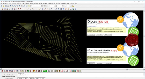
Discav is the indispensable tool for the design of quarries and landfills and for periodic handling controls, the drafting of cultivation plans, for the management of accounting and progress reports.
Inputted from topographic data and calculation of volumes by sections and by prismides according to various methods
Triangle, grid, 2D and 3D contour representation
Advanced drawing management and section calculation
Management of the listed points and the Digital Terrain Model in a single archive where more topographic surveys can be inserted
Earthmoving computation for flattening, artificial pools, quarries, ponds, etc.
Solver for polygonal, celerimetric, planoaltimetric
Survey CAD System pfCAD disCAV v15.0.91
16.5MB
http://s15.alxa.net/001/004/Survey.C...V.v15.0.91.rar
مدخلات من البيانات الطبوغرافية وحساب الأحجام حسب المقاطع ومن قبل prismides وفقا لطرق مختلفة
مثلث ، شبكة ، تمثيل كفاف ثنائي وثلاثي الأبعاد
إدارة الرسم المتقدمة وحساب القسم
إدارة النقاط المذكورة ونموذج التضاريس الرقمية في أرشيف واحد حيث يمكن إدراج المزيد من المسوحات الطبوغرافية
حساب ردم التربة من أجل التسطيح ، الأحواض الاصطناعية ، المحاجر ، الأحواض الأرضية ، إلخ.
Discav is the indispensable tool for the design of quarries and landfills and for periodic handling controls, the drafting of cultivation plans, for the management of accounting and progress reports.
Inputted from topographic data and calculation of volumes by sections and by prismides according to various methods
Triangle, grid, 2D and 3D contour representation
Advanced drawing management and section calculation
Management of the listed points and the Digital Terrain Model in a single archive where more topographic surveys can be inserted
Earthmoving computation for flattening, artificial pools, quarries, ponds, etc.
Solver for polygonal, celerimetric, planoaltimetric
Survey CAD System pfCAD disCAV v15.0.91
16.5MB
http://s15.alxa.net/001/004/Survey.C...V.v15.0.91.rar