Flood Modelling with HEC-RAS
Create Flood Analysis with HEC-RAS and Manage Hydraulic Risk
What you'll learn
Project Setup
Data Preparation
Hydrology
HEC‑RAS Model Building
5. Manning’s n and Roughness
Data model and Boundaries Condition
Inundation Mapping & Post‑Processing
Requirements
Hydraulic Knlodge
Programming
Description
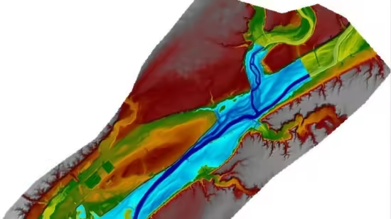
This course provides a practical, step‑by‑step workflow to perform flood (inundation) analysis using HEC‑RAS (steady and unsteady flow, 1D/2D coupled), plus methods to assess and manage hydraulic risk. It covers data needs, model setup, calibration/validation, uncertainty analysis, hydraulic hazard mapping, exposure & vulnerability assessment, risk quantification, and recommended risk reduction and management actions.
Objectives Build an accurate HEC‑RAS model (1D/2D as appropriate) to simulate design storms and observed events.Produce inundation maps and hydraulic outputs for selected return periods (e.g., 2, 5, 10, 25, 50, 100, 200 years).Quantify hydraulic risk by combining hazard, exposure and vulnerability.Provide actionable recommendations for flood risk reduction, monitoring and emergency planning.Scope The workflow is applicable to river reaches, floodplains, urban channels and mixed rural/urban catchments. It assumes available topographic and hydraulic data; it includes optional steps for data‑poor contexts (empirical methods and sensitivity analysis).
Required Data Topography / Bathymetry LiDAR DEM (preferred) or contour survey Cross‑section surveys along the river Channel bathymetry for deeper rivers Hydrologic data Stream flow/gauge records (continuous or event-based)Rainfall records and IDF curves Design hydrographs or frequency analysis (e.g., statistical IDF, flood frequency)Hydraulic data Roughness/Manning’s n estimates (channel and floodplain)Structures: bridges, culverts, weirs (geometry and invert elevations)Land use / Exposure Building footprints, critical infrastructure locations Population or economic value layers Observed flood extents (for calibration/validation) Metadata (datums, coordinate systems)Software & Tools HEC‑RAS (latest stable release) — for 1D, 1D unsteady, 2D flow modeling and 1D/2D coupled setups HEC‑GeoRAS (ArcGIS) or RAS Mapper for GIS integration and pre/post‑processing QGIS/ArcGIS — for preparing terrain, land‑use and producing maps Hydrologic tools — HEC‑HMS, rainfall‑runoff models or frequency analysis scripts Optional: Python/R for batch processing, Monte Carlo uncertainty, economic analysis Workflow (Step‑by‑Step)1. Project Setup Define study reach, objectives and design scenarios (return periods, climate scenarios).
Establish coordinate system and vertical datum (consistent across datasets).2. Data Preparation Process DEM (fill sinks where appropriate, remove artifacts), create terrain for RAS Mapper.Extract cross‑sections: ensure sufficient spacing to capture geometry changes and structures.Digitize structures and lateral boundaries; derive conveyance lines for 2D mesh.3. Hydrology Select design hydrographs: peak flows and hydrograph shapes for each return period.
If gauge data available: perform frequency analysis (e.g., Log‑Pearson III) to obtain design discharges.For ungauged basins: use regional regression, HEC‑HMS, or scaling from nearby stations.4. HEC‑RAS Model Building Create geometry (river stations and cross‑sections) in RAS Mapper or geometry editor.Input structures (bridges, culverts) with accurate geometry and loss coefficients.Choose modeling approach:Steady flow (1D) for cross‑sectional water surface profiles (quick assessments). Unsteady (1D) for hydrograph routing, backwater effects and dam break.2D or 1D/2D coupled for detailed floodplain flows and urban overland routing.Set boundary conditions (flow hydrographs or stage) and initial conditions for unsteady runs.5. Manning’s n and Roughness Assign Manning’s n values based on land cover; define spatial variation for floodplains.Document assumptions and ranges for sensitivity testing.6. Calibration & Validation Calibrate using observed water levels, high‑water marks or historic flood extents.Adjust roughness, lateral flow parameters or structure losses within reasonable ranges.Validate model on an independent event if available; document performance metrics (NSE, RMSE, bias).7. Uncertainty & Sensitivity AnalysisPerform sensitivity runs for Manning’s n, boundary hydro graphs, and structure parameters.Consider Monte Carlo sampling or scenario analysis to propagate input uncertainties to flood extents and depths.
Present confidence intervals for water depth and inundation area.8. Inundation Mapping & Post‑ProcessingExport HEC‑RAS water surface rasters or depth grids for each scenario.Combine with DEM to generate depth and velocity maps (depth = W.S. − DEM). Produce maps for specific return periods and probabilistic hazard (e.g., 5th–95th percentile inundation).9. Exposure & Vulnerability Assessment Overlay inundation maps with exposure layers (buildings, infrastructure, population). Assign vulnerability curves (depth–damage functions) for asset types.Calculate expected annual damage and scenario damage for each return period.10. Risk Quantification Compute risk as Hazard × Exposure × Vulnerability.Aggregate results spatially (per parcel, administrative unit) and by asset type.Optionally compute economic metrics: Expected Annual Damage (EAD), Benefit‑Cost Ratios for mitigation.11.
Decision Support & Risk Management Prioritize interventions using risk rankings: structural (levees, bypasses), non‑structural (zoning, early warning), nature‑based solutions (riparian restoration). Define monitoring plans (gauges, telemetry), maintenance of structures, and emergency response triggers.Consider adaptation pathways and climate change scenarios in long‑term planning.12. Reporting & Communication Produce technical report: methods, data, calibration results, uncertainty, maps, recommended measures.Create clear non‑technical summaries and maps for stakeholders and the public.Provide GIS layers and HEC‑RAS project files as deliverables.Quality Assurance / Quality Control (QA/QC)Maintain a data log and metadata for all inputs.Version control for HEC‑RAS projects and scripts.Peer review of model setup, calibration and assumptions.Sensitivity checks for critical parameters and structure geometry.Deliverables (Suggested)HEC‑RAS project folder (geometry, plan files, flow files, 2D mesh if used).GIS layers: DEM, inundation rasters, depth maps, velocity maps, exposure overlays.Technical report and non‑technical summary with maps and recommended measures.Spreadsheet of damage estimates, EAD, and mitigation cost‐benefit analysis.
Who this course is for
Engeenering
Geologist
Published 9/2025
MP4 | Video: h264, 1280x720 | Audio: AAC, 44.1 KHz, 2 Ch
Language: English | Duration: 6h 58m | Size: 4.09 GB
Download
🔒 Go Premium to Unlock
Create Flood Analysis with HEC-RAS and Manage Hydraulic Risk
What you'll learn
Project Setup
Data Preparation
Hydrology
HEC‑RAS Model Building
5. Manning’s n and Roughness
Data model and Boundaries Condition
Inundation Mapping & Post‑Processing
Requirements
Hydraulic Knlodge
Programming
Description
This course provides a practical, step‑by‑step workflow to perform flood (inundation) analysis using HEC‑RAS (steady and unsteady flow, 1D/2D coupled), plus methods to assess and manage hydraulic risk. It covers data needs, model setup, calibration/validation, uncertainty analysis, hydraulic hazard mapping, exposure & vulnerability assessment, risk quantification, and recommended risk reduction and management actions.
Objectives Build an accurate HEC‑RAS model (1D/2D as appropriate) to simulate design storms and observed events.Produce inundation maps and hydraulic outputs for selected return periods (e.g., 2, 5, 10, 25, 50, 100, 200 years).Quantify hydraulic risk by combining hazard, exposure and vulnerability.Provide actionable recommendations for flood risk reduction, monitoring and emergency planning.Scope The workflow is applicable to river reaches, floodplains, urban channels and mixed rural/urban catchments. It assumes available topographic and hydraulic data; it includes optional steps for data‑poor contexts (empirical methods and sensitivity analysis).
Required Data Topography / Bathymetry LiDAR DEM (preferred) or contour survey Cross‑section surveys along the river Channel bathymetry for deeper rivers Hydrologic data Stream flow/gauge records (continuous or event-based)Rainfall records and IDF curves Design hydrographs or frequency analysis (e.g., statistical IDF, flood frequency)Hydraulic data Roughness/Manning’s n estimates (channel and floodplain)Structures: bridges, culverts, weirs (geometry and invert elevations)Land use / Exposure Building footprints, critical infrastructure locations Population or economic value layers Observed flood extents (for calibration/validation) Metadata (datums, coordinate systems)Software & Tools HEC‑RAS (latest stable release) — for 1D, 1D unsteady, 2D flow modeling and 1D/2D coupled setups HEC‑GeoRAS (ArcGIS) or RAS Mapper for GIS integration and pre/post‑processing QGIS/ArcGIS — for preparing terrain, land‑use and producing maps Hydrologic tools — HEC‑HMS, rainfall‑runoff models or frequency analysis scripts Optional: Python/R for batch processing, Monte Carlo uncertainty, economic analysis Workflow (Step‑by‑Step)1. Project Setup Define study reach, objectives and design scenarios (return periods, climate scenarios).
Establish coordinate system and vertical datum (consistent across datasets).2. Data Preparation Process DEM (fill sinks where appropriate, remove artifacts), create terrain for RAS Mapper.Extract cross‑sections: ensure sufficient spacing to capture geometry changes and structures.Digitize structures and lateral boundaries; derive conveyance lines for 2D mesh.3. Hydrology Select design hydrographs: peak flows and hydrograph shapes for each return period.
If gauge data available: perform frequency analysis (e.g., Log‑Pearson III) to obtain design discharges.For ungauged basins: use regional regression, HEC‑HMS, or scaling from nearby stations.4. HEC‑RAS Model Building Create geometry (river stations and cross‑sections) in RAS Mapper or geometry editor.Input structures (bridges, culverts) with accurate geometry and loss coefficients.Choose modeling approach:Steady flow (1D) for cross‑sectional water surface profiles (quick assessments). Unsteady (1D) for hydrograph routing, backwater effects and dam break.2D or 1D/2D coupled for detailed floodplain flows and urban overland routing.Set boundary conditions (flow hydrographs or stage) and initial conditions for unsteady runs.5. Manning’s n and Roughness Assign Manning’s n values based on land cover; define spatial variation for floodplains.Document assumptions and ranges for sensitivity testing.6. Calibration & Validation Calibrate using observed water levels, high‑water marks or historic flood extents.Adjust roughness, lateral flow parameters or structure losses within reasonable ranges.Validate model on an independent event if available; document performance metrics (NSE, RMSE, bias).7. Uncertainty & Sensitivity AnalysisPerform sensitivity runs for Manning’s n, boundary hydro graphs, and structure parameters.Consider Monte Carlo sampling or scenario analysis to propagate input uncertainties to flood extents and depths.
Present confidence intervals for water depth and inundation area.8. Inundation Mapping & Post‑ProcessingExport HEC‑RAS water surface rasters or depth grids for each scenario.Combine with DEM to generate depth and velocity maps (depth = W.S. − DEM). Produce maps for specific return periods and probabilistic hazard (e.g., 5th–95th percentile inundation).9. Exposure & Vulnerability Assessment Overlay inundation maps with exposure layers (buildings, infrastructure, population). Assign vulnerability curves (depth–damage functions) for asset types.Calculate expected annual damage and scenario damage for each return period.10. Risk Quantification Compute risk as Hazard × Exposure × Vulnerability.Aggregate results spatially (per parcel, administrative unit) and by asset type.Optionally compute economic metrics: Expected Annual Damage (EAD), Benefit‑Cost Ratios for mitigation.11.
Decision Support & Risk Management Prioritize interventions using risk rankings: structural (levees, bypasses), non‑structural (zoning, early warning), nature‑based solutions (riparian restoration). Define monitoring plans (gauges, telemetry), maintenance of structures, and emergency response triggers.Consider adaptation pathways and climate change scenarios in long‑term planning.12. Reporting & Communication Produce technical report: methods, data, calibration results, uncertainty, maps, recommended measures.Create clear non‑technical summaries and maps for stakeholders and the public.Provide GIS layers and HEC‑RAS project files as deliverables.Quality Assurance / Quality Control (QA/QC)Maintain a data log and metadata for all inputs.Version control for HEC‑RAS projects and scripts.Peer review of model setup, calibration and assumptions.Sensitivity checks for critical parameters and structure geometry.Deliverables (Suggested)HEC‑RAS project folder (geometry, plan files, flow files, 2D mesh if used).GIS layers: DEM, inundation rasters, depth maps, velocity maps, exposure overlays.Technical report and non‑technical summary with maps and recommended measures.Spreadsheet of damage estimates, EAD, and mitigation cost‐benefit analysis.
Who this course is for
Engeenering
Geologist
Published 9/2025
MP4 | Video: h264, 1280x720 | Audio: AAC, 44.1 KHz, 2 Ch
Language: English | Duration: 6h 58m | Size: 4.09 GB
Download
🔒 Go Premium to Unlock